
In this project our goal was to reach a POC of a topographic mapping method using an IoT sensors system. The system needs to measure altitudes and coordinates using sensors which are spread across the terrain, and send the data to a main computer, where a topographic map will be created. Altitudes at unmeasured points are estimated using an interpolation method.
Beginning this project we studied deeply different interpolation methods, measuring methods and the optional communication methods. Next, we developed a mapping simulation that and included in it all the factors we expected from the real mapping. Based on conclusions from the simulations we selected and put together the components used to measure and communicate while considering prices and accuracy/performance.
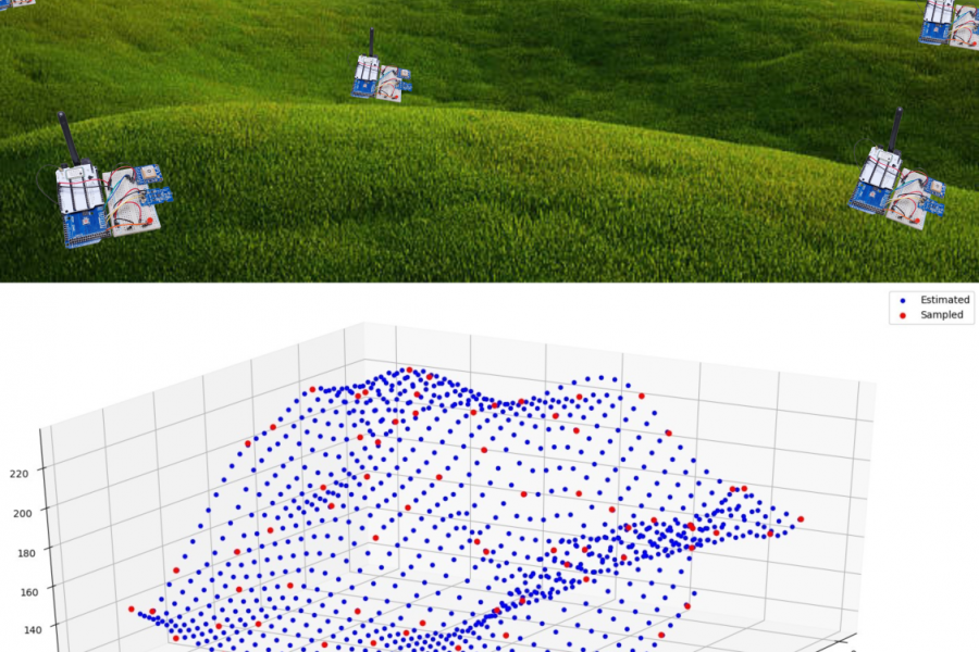
To check the viability of our proposed concept, we conducted an experiment using our physical system, and analyzed the results. In addition, we preformed additional simulations, testing various parameters of the system.
Finally, using the results from the analysis above, we reached our final conclusions on the system and its future possibilities.